FAST
Changing environment, Growing City and
Evolving Map
Changing environment, Growing City and
Evolving Map
Drawing real-time Korea today
One of the fastest growing countries in the world, Korea had whole lot of changes for the last 30 years. Empty fields with just a few tree lines were filled with complicated road network and high buildings, mountains have disappeared and hills were filled with high apartments and condos. Without missing a change along with the years, the Mappers was the one to witnessed all of what happened on site creating fast and exact map to present real-time Korea.
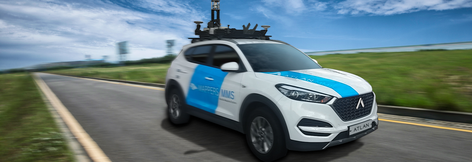
Driving length of over 10 times around the earth each year, Mappers map is drawn today
The biggest market share with recognition of the best navigation software in Korea.
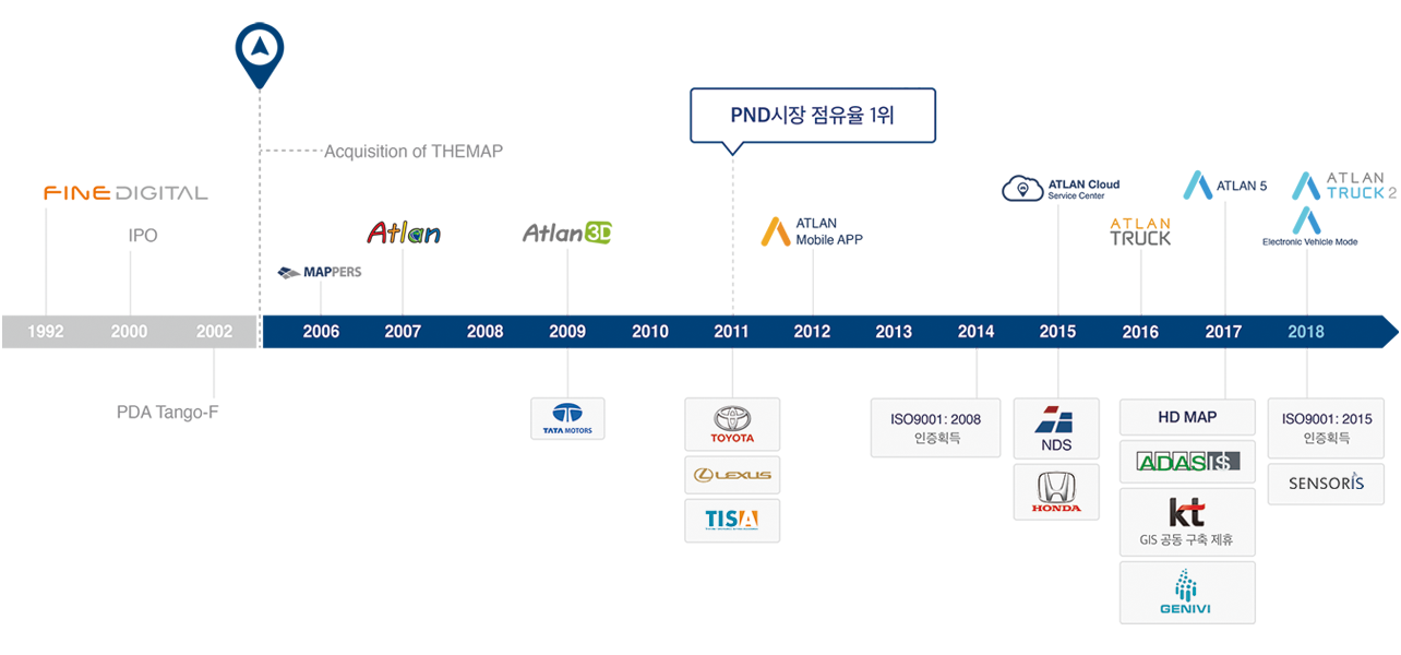
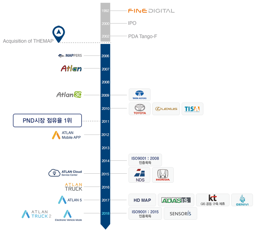
In June of year 2006, we have turned engine of map database collecting vehicle as the first step forward without anyone watching. With driving over 10 times length of the earth each and every year, we have created very best navigation brand “Atlan” that presents rapidly changing world and it became the name of navigation in Korea. Even now, the value of Atlan is created with seamless technology developments and new services leading the market. We presented the first cloud navigation application in the market and are leading connected car market with the hybrid navigation service using dedicated mobile navigation as well. Under the company motto of “Serving customer happiness by providing the best map service”, Mappers are running forward today.
Constantly evolving technology, that is the innovation we pursue
Atlan is evolving into the 3D electronic maps of Korea based on the experiences that Mappers has accumulated over the last decade. The core competitiveness that supports the evolution is our ability to provide the latest information quickly, at all times with accurate map data. We ensure all our products, both automotive navigation systems and personal navigation devices, are based on the latest data by aggressively applying communication technology. This tenacious effort made it possible for us to launch Korea's first cloud-based 3D navigation app. At this very moment, we are working day and night to provide new services that Atlan's customers could never imagine to have before. We relentlessly seek to create a map tailored just for you, not just a simple map you use to find your way around. Our technology that has no boundary on imagination is evolving tirelessly.
With the cloud-based map service, we will continue our journey of innovation for our customers
With over decades of experience developing precise digital maps and top-notch software technology, Mappers advances as a map solution provider through continuous research and innovation.